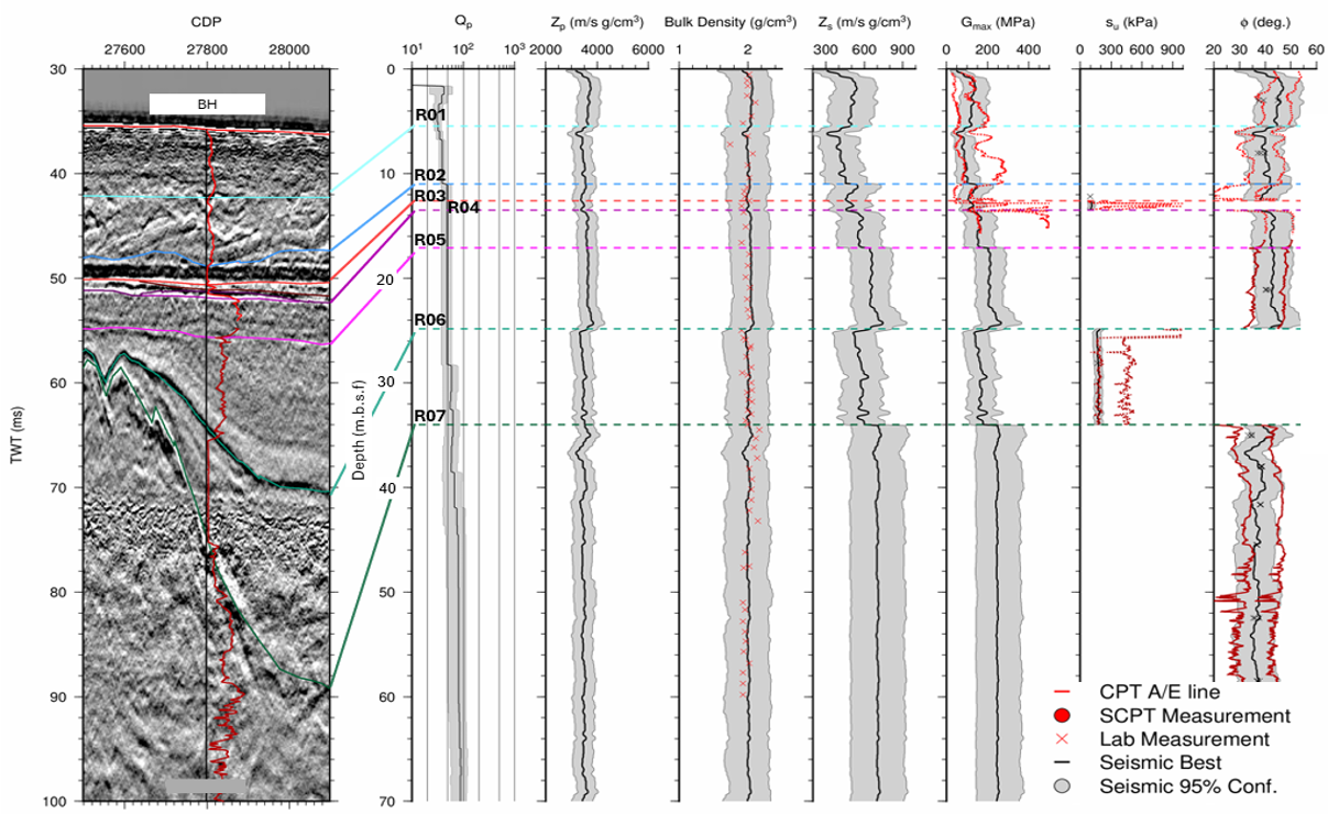
SAND delivers tailored survey solutions using a full suite of geophysical sensors, including multi-channel ultra-high-resolution seismic surveys, with expert teams handling acquisition, processing, and interpretation.
Mapping & surveying
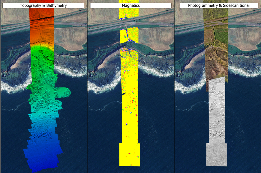
SAND Geophysics delivers high-quality marine mapping and surveying services to support a wide range of offshore infrastructure projects, including offshore renewable developments, port and harbour expansions, and pre-construction investigations such as UXO detection and detailed geological mapping.
Get in touch with your project requirements and our team of specialist surveyors and geophysicists will provide tailored survey and consultancy services to deliver accurate and effective results for your specification.
With the growth of offshore wind farms and international subsea cable networks, the demand for accurate cable route surveys has never been higher. SAND brings extensive experience in both shallow and deepwater operations, combining land and marine data to deliver a comprehensive understanding of cable landing conditions. Our surveys help clients optimise the design, dredging, installation, conservation and decommissioning of subsea cables by providing:
Detailed bathymetric mapping
Subsurface geological imaging & interpretation
Identifying potential obstructions & UXO
Locating pre-existing infrastructure
Sensor Type
MBES, TVG, SSS, SBP, with the addition Magnetic Drone Survey (UAVs)
Support
Survey planning consultation
Survey personnel
Remote survey support
Processing personnel
Integrating land and marine data
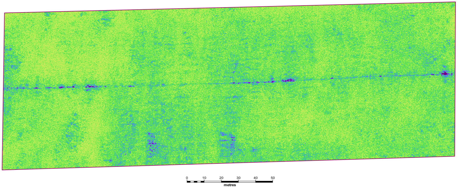
Depth of Burial
As international subsea cable networks and pipeline systems continue to expand, accurate depth of burial surveys have become essential for ensuring the long-term safety and integrity of these critical assets. Using the latest survey technologies, SAND Geophysics works closely with clients to monitor and assess the burial depth of subsea infrastructure, including:
Cable & Pipeline depth of burial
Buried objects such as debris & UXO
Sensor Type
SBP, 3D chirp, SUHRS, MUHRS
Support
Survey planning consultation
Survey personnel
Processing personnel
Engineering
Over the past decade, SAND has worked alongside UXO specialists to provide customised services to support our clients’ safe and efficient project execution at various stages of geotechnical investigation and infrastructure engineering including:
Site investigation in river environments and both nearshore and offshore
UXO clearance surveys for proposed borehole locations
Pre- and post-installation surveys to support construction activities
Sensor Type
MBES, TVG, SSS, SBP and addition of 3DChirp
SBP, S-UHRS, M-UHRS
Support
Survey planning consultation
Survey personnel
Remote survey support
Processing personnel
Environmental
SAND Geophysics provides both geophysical and GIS support to assist with the planning and data analysis of environmental surveys, such as:
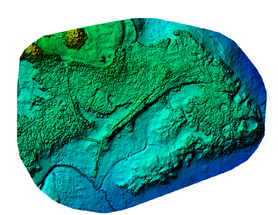
Drone based vegetation mapping
GIS charting
Benthic survey planning
Spatial Analysis
Sensor Type
MBES, SSS, Drone Lidar/ Photogrammetry
Support
Geophysical survey spread
Survey personnel
Data processing and interpretation
GIS deliverables and charting
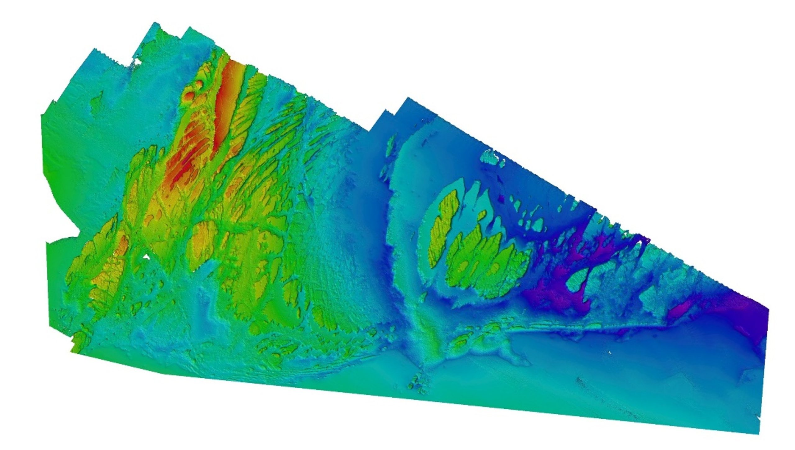
Hydrographic Survey
SAND Geophysics delivers hydrographic surveys to IHO standards, supporting a wide range of marine projects. Our capabilities include:
Establishing water depths
Determining seabed and sub-seabed stratigraphy
Hydrographic charting
Hydrographic data can be seamlessly integrated with our geophysical survey services to provide a complete and comprehensive dataset.
Sensor Type
MBES
Support
Survey planning consultation
Survey and processing personnel
Software rental
Survey Support
Flexible, skilled support can make a big difference to project efficiency and cost-effectiveness. SAND’s experienced personnel bring a wide range of expertise to tailor support and assist clients in:
UXO diver positioning support
Remote survey setup and quality control for geophysical surveys
Equipment rental
Mobilisation engineer
Planning and survey consultation
GIS support and charting
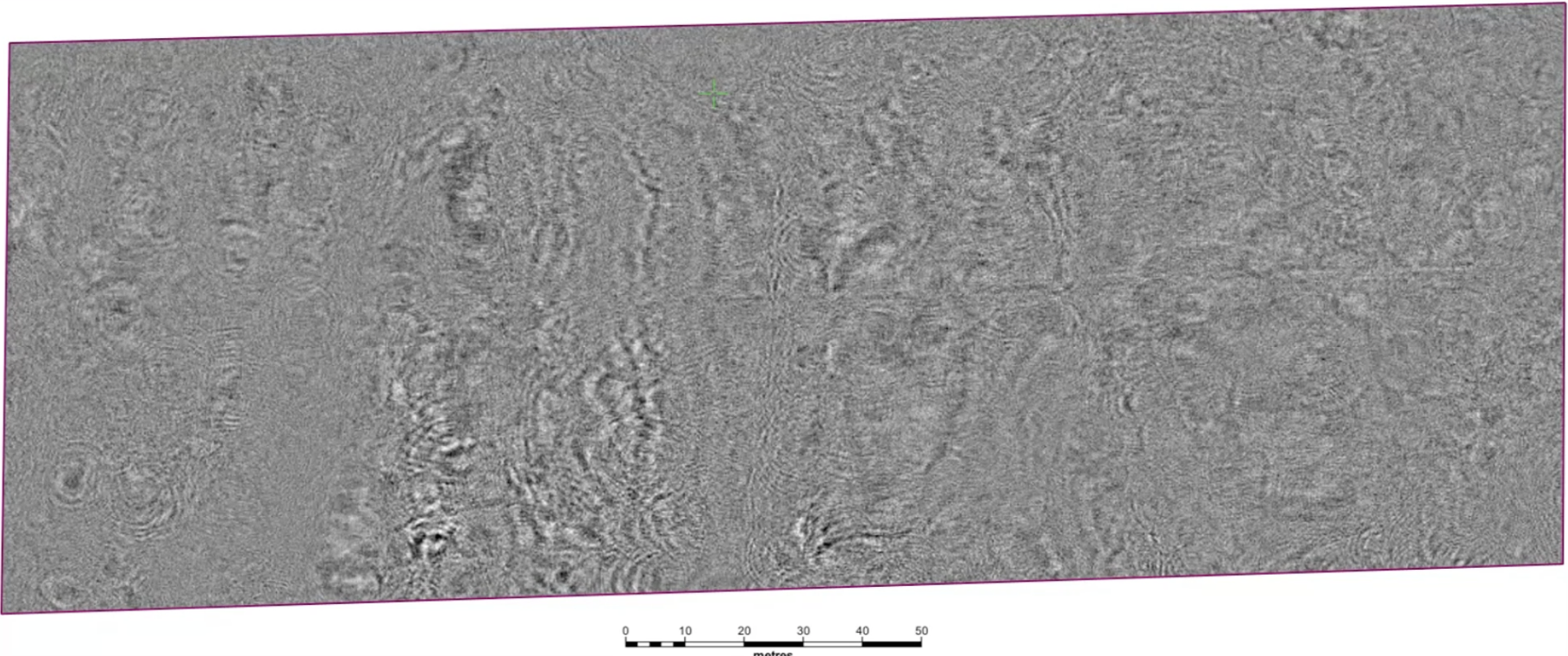
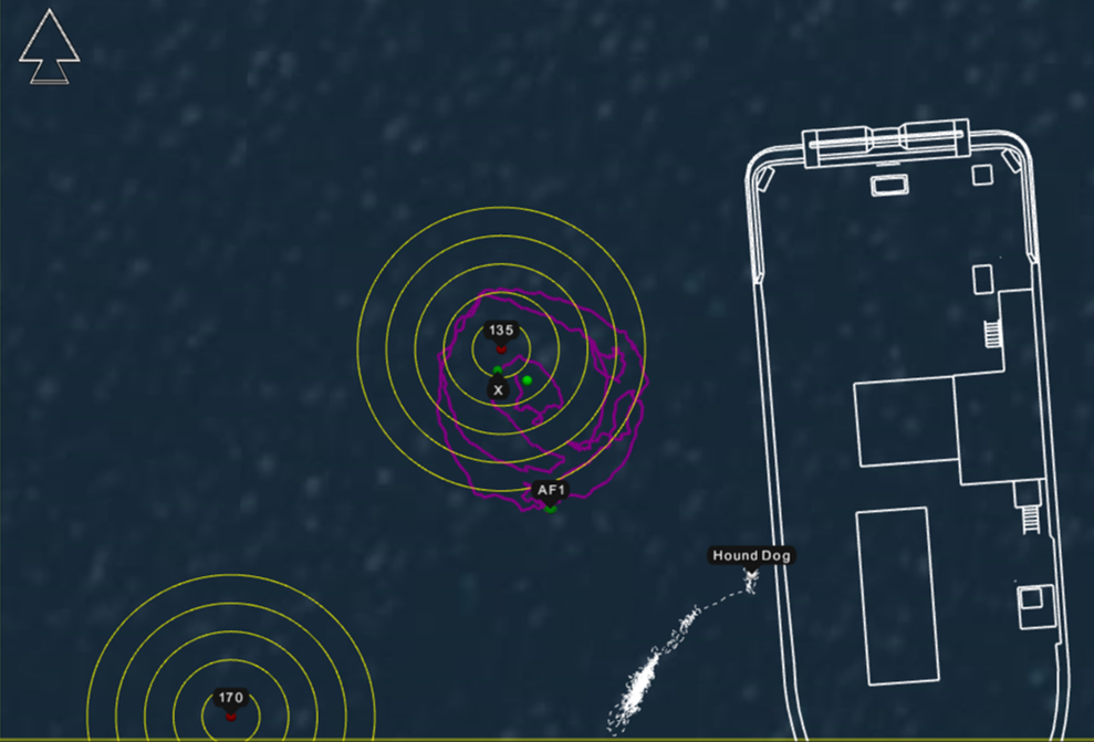
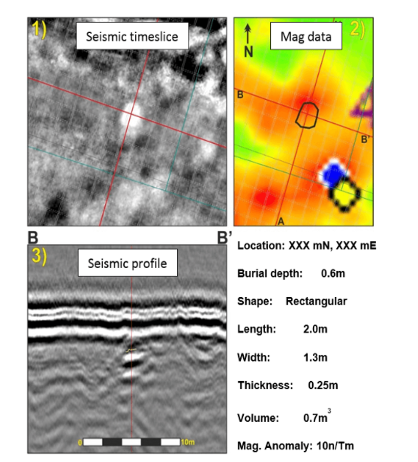
UXO & Debris
UXO surveys are a priority for both offshore and nearshore projects where the mitigation of these ordnance is critical for both the safety and functionality of any planned works.
SAND Geophysics brings extensive experience in marine UXO and debris detection, providing clients with accurate, actionable data to support project planning, including:
Clearance surveys prior to infrastructure development
Monitoring movement of previously identified ordnance
Supporting ALARP certification
Sensor Type
TVG, SSS, MBES, and the addition of 3D-Chirp
SAND Geophysics can also work to support data acquisition with ROVs
Support
Survey planning and consultation to align with client specifications
Deployment of survey spreads to identify UXO and debris
Data processing and interpretation, including correlation across multiple datasets
Collaboration with UXO consultants to support ALARP (As Low As Reasonably Practicable) submissions
Get in touch
Talk to us today about our work or your own project