SAND provides tailored data processing and re-processing services to maximise the value and quality of geophysical datasets.
Data Processing Services
SAND Geophysics has extensive experience applying custom processing techniques to challenging datasets and complex survey environments, maximising the quality and interpretability of geophysical data. We utilise a combination of industry standard software and bespoke in-house software to deliver high quality results. All processed data and deliverables can be supplied in standard formats for seamless integration into project workflows.
Previous projects have included re-processing seismic profiles to increase resolution at depth and analysis of multi-beam echo sounder data to identify issues within the data and provide solutions.
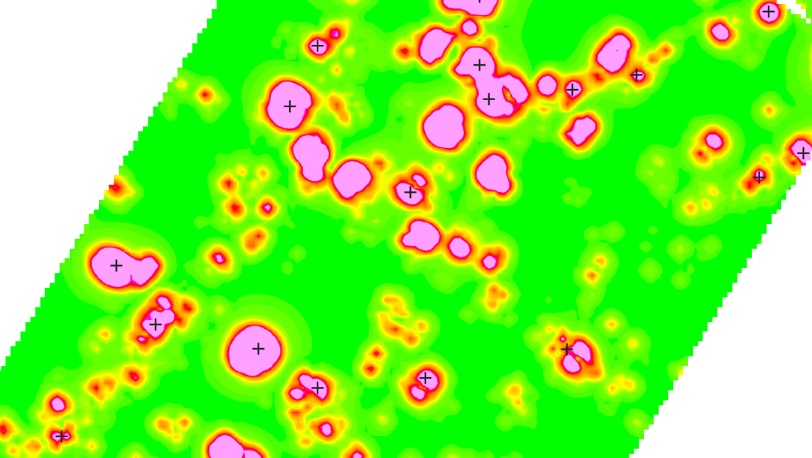
SAND produces high-resolution magnetometer datasets for UXO assessments and magnetic anomaly analysis, using tailored workflows to meet project requirements. Our services include:
Cleaning and conditioning navigation, altitude, and magnetometer data
Diurnal and geological corrections
Magnetic anomaly interpretation
Generating full set of deliverables, from gridded data to target exports & shapefiles
Software
Oasis Montaj
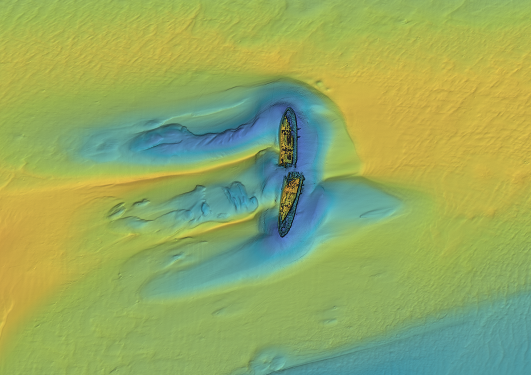
MBES
SAND provides a complete multibeam echosounder (MBES) data processing workflow from raw data handling and patch test analysis to generating final deliverables and reporting, all tailored to your project requirements. Our services include:
Navigation post-processing
Sound velocity correction
Motion correction
Tidal correction
Surface cleaning
Datum transformation
Generating QC report & final deliverables (Geotiff, XYZ, FLT etc)
Software
Beamworx AutoClean
Eiva NaviSuite
QPS Qimera
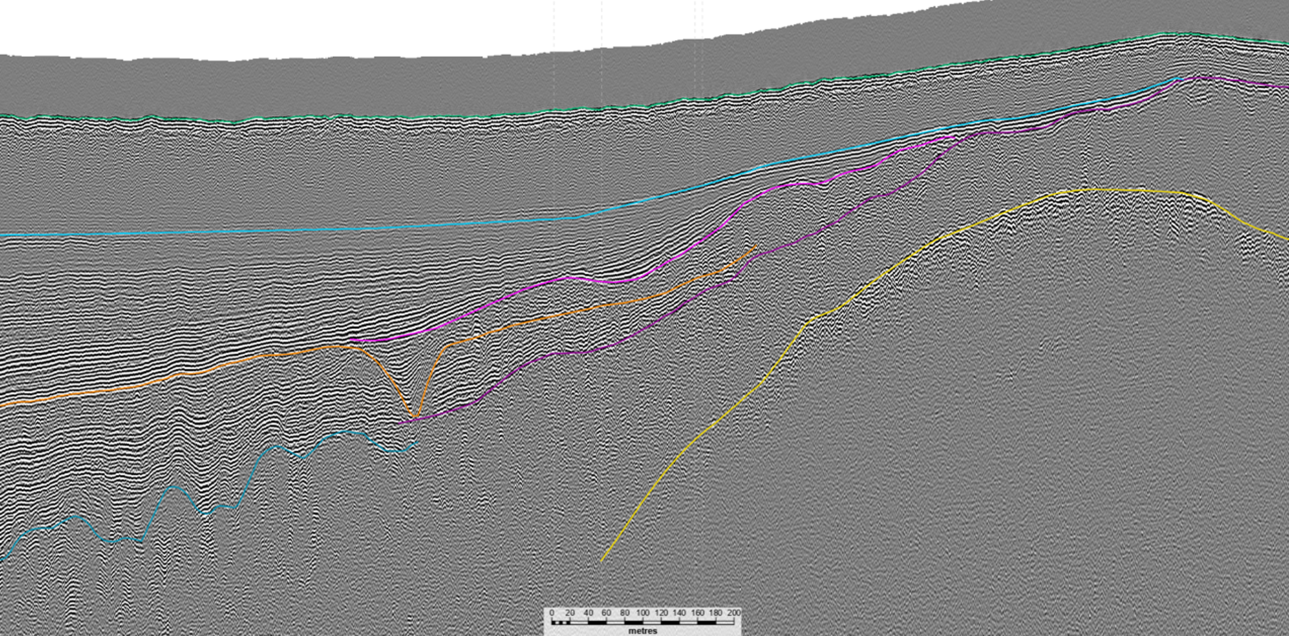
Seismic
SAND’s seismic specialists are experienced in the processing and interpretation of a wide range of seismic datasets, from sub-bottom profiler and single channel seismics to multi-channel ultra-high resolution seismics in both 2D and 3D.
SAND has extensive experience working with data from a variety of seismic source types, including:
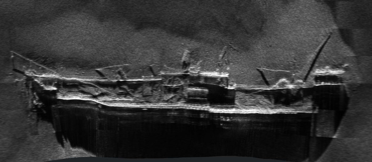
SAND provides a complete sidescan sonar (SSS) processing workflow from raw data processing to final deliverables and reporting, tailored to your requirements. Our services include:
Navigation cleaning
Processing high and low frequency datasets
Mosaic building
Coverage report
Contact picking and interpretation report
Seafloor sediment and morphology interpretation
Generating final deliverables (Geotiff, GIS Shapefile, XTF, JSF etc)
Software
Chesapeake SonarWiz
Moga Seaview
Get in touch
Talk to us today about our work or your own project